1910-1919 Date Range Antique Europe Folding Maps
424 Results
1919 Original Old Folding Muirhead Guide Tube & Tramway Map of London 17" x 13"
ILS 211.06ILS 38.23 shippingEdwardian Philips' Tape Map of London, George & Son Ltd c1910 Green Outer boards
ILS 2,293.53ILS 275.55 shippingOld Folding Map Northern & Central Italy & Corsica 1913 10.5" x 10.25"
ILS 117.26ILS 38.23 shippingOld City Original Folding Map Bologna Italy 1913 9.5" x 8" Karl Baedecker
ILS 93.81ILS 38.23 shippingBacon's New Large Print Map of London and Suburbs - Circa 1914
ILS 164.16ILS 128.09 shippingAntique Ordnance Survey Map of Liverpool Coloured edition 1 Inch to 1 Mile 1913
ILS 70.350 bidsILS 96.48 shippingEnding May 7 at 2:40PM PDT5d 9hOrdnance Survey half inch layered map Portsmouth & Isle of Wight Sheet 38. 1914
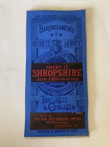
ILS 39.870 bidsILS 56.28 shippingEnding May 7 at 3:51AM PDT4d 22hShropshire Vintage Bartholomews Map Shrewsbury Kidderminster C1910 Welshpool Old
ILS 42.17ILS 38.93 shippingNorth West Europe Sheet 4 1:250,000 War Office Map Apr 1918 ww1
ILS 93.81ILS 113.08 shipping1912 Ordnance Survey Map mile=1 inch. Watford & Wycombe. Large Sheet Series
ILS 46.86ILS 24.39 shippingAntique Folding Sectional Map of Chatham Cloth Backed Paper Map
ILS 58.630 bidsILS 95.68 shippingEnding May 7 at 2:40PM PDT5d 9hc1920 Bacon's Cycling & Motoring Map of LIVERPOOL & NORTH WALES - Cloth Map
ILS 23.45ILS 23.45 shipping1913 LAKE DISTRICT CUMBRIA Ordnance Survey Cloth Map - Half Inch to 1 Mile - #5
ILS 46.90ILS 92.63 shipping1911 antique color map - england and wales !
ILS 107.83ILS 56.28 shipping1919 Original Old Folding Muirhead Street Maps x 4 of London each 9.5" x 6.5"
ILS 187.61ILS 38.23 shippingOld City Folding Map Milano Milan Italy 1913 9" x 9"
ILS 117.26ILS 34.71 shippingNORTH MIDDLESBROUGH St Hilda's 1913 - Old Ordnance Survey Maps Godfrey Edition
ILS 21.11ILS 21.11 shipping1912 Vintage Ordnance Survey White Edition Cloth Map Hastings & Bexhill Sussex
ILS 70.35ILS 94.18 shippingFrance Amiens 17 2nd Edition Map 1:100,000 War Office / Ordnance Survey 1916 ww1
ILS 93.81ILS 113.08 shipping1910 Borneo Entry with Map Encyclopedia Britannica Vintage Wall Decor Old Atlas
ILS 18.77ILS 271.06 shippingOrdnance Survey Map - Vintage - Norwich
ILS 46.900 bidsILS 88.88 shippingEnding May 9 at 5:52AM PDT7dCHESTERFIELD 1914 - Old Ordnance Survey Maps Godfrey Edition
ILS 21.11ILS 21.11 shippingww1 French Map Carte Guide Campbell No. 2 NORD May 1915
ILS 93.81ILS 125.60 shippingww1 Folding Map France Amiens 17 1:100,000 War Office / Ordnance Survey 1916
ILS 93.81ILS 113.08 shippingW H Smith Plan of London N W Section J. Bartholomew FRGS circa 1913
ILS 46.90ILS 112.33 shippingBerwick and Haddington Antique 1912 Bartholomews Map Edinburgh Dunbar
ILS 64.21ILS 31.89 shipping1911 Linen Back OS Map Cheshire Sheet XXXV S.E. 6" to 1 Mile, Old Withington Etc
ILS 56.28ILS 96.53 shippingVINTAGE ORDNANCE SURVEY MAP SHEET 106 OXFORD AND HENLEY WHITE EDITION DATED 1912
ILS 93.81ILS 117.58 shipping1911 Vintage Folding Map Plan of The Isle of Man John Bartholomew 14" x 11"
ILS 187.61ILS 36.35 shippingOld City Original Folding Map Genova Italy 1913 12" x 12" Karl Baedecker
ILS 93.81ILS 34.71 shippingOld Folding Map Lake Como Italy 1913 8.25" x 6"
ILS 93.81ILS 38.23 shippingAntique Ordnance Survey Folding Map Early 1900s - Sheffield, England Sheet 37
ILS 40.88ILS 167.25 shipping1910 Gall & Inglis / Cary: Easton's Touring & Motoring Map of Peebles & District
ILS 70.31ILS 36.58 shipping1914 BRISTOL & CARDIFF Ordnance Survey Cloth Map - ½ inch to 1 Mile
ILS 46.90ILS 92.63 shippingc1910 Philips CYCLISTS MAP of LANCASHIRE - Cloth Mounted Excellent Condition
ILS 46.90ILS 105.30 shippingAntique Ordnance Survey Map - The Campo Of Gibraltar - 1912
ILS 1,172.56ILS 149.29 shippingTrier German Empire Original Antique Lithograph Map 1900 Royal Prussian
ILS 70.35ILS 17.82 shippingBartholomew's Survey Map of CHESHIRE (c1910) Sheet 12 England, Folding Cloth Map
ILS 70.31ILS 79.50 shipping1911 Vintage Folding Map Plan of Douglas Isle of Man John Bartholomew 9" x 8.5"
ILS 117.26ILS 38.23 shippingAntique Ordnance Survey Folding Map Early 1900s - Bradford, England Sheet 69
ILS 40.88ILS 167.25 shipping1910 Bartholomew's New Reduced Survey. Sheet 24 Gair Loch & Loch Inver Scotland
ILS 37.48ILS 36.58 shipping1910 The Courier Map of Dumfriesshire for cyclists, Motorists etc - Bartholomew
ILS 84.38ILS 36.58 shippingSCARBOROUGH (West) 1910 - Old Ordnance Survey Maps Godfrey Edition
ILS 21.11ILS 21.11 shipping1915 COLOUR MAP OF THE EUROPEAN WAR THE EASTERN CAMPAIGN BY SIFTON PRAED & CO*
ILS 46.86ILS 79.73 shippingc1910 LIVERPOOL & MANCHESTER Bartholomew's Ordnance Survey Map Tourist & Cyclist
ILS 35.18ILS 23.45 shippingWWI Allies' Map of Western Front George Philip & Son Ltd London Geo Inst
ILS 149.98ILS 261.07 shippingOrdnance Survey 1/2" Cloth Map Sheet 16 Wrexham Shrewsbury c1913
ILS 39.870 bidsILS 56.28 shippingEnding May 7 at 4:30AM PDT4d 23hBelgium B Series Sheet 28 N.W. Folding Map 1:20,000 Ordnance Survey 1915 ww1
ILS 93.81ILS 113.08 shippingFrance Sheet 51c Edition 1 ww1 Era Map 1:40,000
ILS 93.81ILS 125.60 shippingLarge Post WWI Liberty Map of New Europe & New Map Of Africa 1914-1920
ILS 140.79ILS 260.47 shipping1912 Vintage Ordnance Survey White Edition Map CHICHESTER & WORTHING Sussex 136
ILS 70.35ILS 94.18 shippingEDINBURGH: Huge Antique map Post Office boundaries history 1917 Leith Portabello
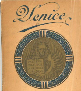
ILS 164.16ILS 120.26 shipping1911 Venice illustrated Guide Pull Out Color Map
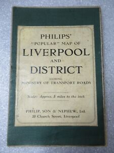
ILS 563.11ILS 285.14 shippingc1910 Philips MAP of LIVERPOOL & DISTRICT N. Wales Manchester CLOTH 74cm x 100cm
ILS 93.81ILS 125.42 shipping1918 MAP OF THE WESTERN THEATRE OF WAR National Geographic Society Antique
ILS 67.39Was: ILS 74.90ILS 257.24 shippingMap ca. 1915 Schlachtenplan 14-Lemberg-Czernowitz-Waldkarpathen-Dnjester
ILS 75.05ILS 37.54 shipping1911 Ordnance Survey Folding Map 6 mile= inch. Stanwell, Harmondsworth, Horton
ILS 140.66ILS 72.70 shipping1919 Antique Folding Map; Ordnance Survey; Abinger, Wotton, Holmbury. 1"=6 mile
ILS 23.40ILS 24.39 shippingOld City Folding Map Torino Turin Italy 1913 9.5" x 9.5"
ILS 117.26ILS 34.71 shippingOld Folding Map Pisa Italy 1913 8.25" x 6"
ILS 140.71ILS 38.23 shipping