
Copper Plate County Map Antique Folding Maps
All
Auction
Buy It Now
50 Results
1695 JOHN MORDEN MAP CUMBERLAND CAMDENS BRITANNICA HAND COLOURED Swale Awnsham
ILS 610.99ILS 157.32 shipping* Rare * Copperplate Engraved Map of Essex By John Seller Hand Coloured 1695
ILS 423.03ILS 74.97 shippingMap Of Bagshot to Southampton By John Senex Coloured By Hand 1767
ILS 352.52ILS 74.97 shippingDer Ober Rheinische Kreis Homann Erben ( 1724 - 1780 ) Nuremberg
ILS 936.42ILS 350.78 shipping1662 SCARCE WILLEM & JOAN BLEAU MAP DEVONSHIRE HAND COLOURED
ILS 1,175.03ILS 190.83 shipping1673 MAP OF MONMOUTHSHIRE BY RICHARD BLOME WITH COLOUR CARTOUCHE MOUNMOUTHSHIRE
ILS 140.96ILS 79.90 shippingVintage Bacon's New Cycling Road Map Of Reading And District
ILS 70.50ILS 82.63 shippingVintage Bacon's Cycling Road County Map Of The Lincoln
ILS 70.50ILS 82.63 shippingVintage W & A Bates Road Map Of Eastern Counties Tyres
ILS 70.50ILS 82.63 shippingVintage Bacon's Cycling And Motoring Map Of Norwich District Waistcoat Folding
ILS 70.50ILS 82.63 shippingAntique 1700's ? Copper Engraved Asia Map Watermark Germany Arabia India China
ILS 299.62ILS 259.05 shipping1748 A CORRECT MAP OF BRECKNOCKSHIRE IN SOUTH WALES BY OSBORNE CRICKHOWEL *
ILS 46.96ILS 61.10 shipping1757 Antique Folding Map: Rocque's Map of Middlesex
ILS 5,875.36ILS 72.85 shipping“Electoratus et Palatinatus Rheni (Map of the Historical Rhine Electorate)”
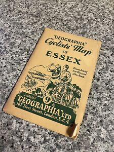
ILS 561.85ILS 324.75 shippingVintage Geographia Cyclists Map Of Essex
ILS 70.50ILS 97.67 shipping1832 CARY MAP Cardiganshire - Cardigan bay Merionethshire Wales LINEN HAND COL
ILS 446.53ILS 108.11 shippingDunlop Touring Maps Of Great Britain And Ireland No.10 Eastern Counties
ILS 70.50ILS 97.67 shipping1787 LARGE ANTIQUE COPPER PLATE MAP - MIDDLESEX LONDON - JOHN HARRISON
ILS 140.77ILS 124.46 shippingVintage Philips’ Cyclist Map Of The County Of Surrey
ILS 70.50ILS 97.67 shippingVintage Bacon's Cycling And Motoring Map Of Norwich District Waistcoat Folding
ILS 70.50ILS 82.63 shippingAntique 1700s ? Copper Engraved Hungary Turkey Europe Poland Italy Map Watermark
ILS 299.62ILS 259.05 shippingAntique Mid 1700's Copper Engraved Turkey Asia Daniel Pomarede Engraver
ILS 299.62ILS 259.05 shippingBartholomews Half Inch Maps Sheet 5 New Forest
ILS 70.50ILS 97.67 shipping1789 LARGE ANTIQUE COPPER PLATE MAP - DURHAM - JOHN HARRISON
ILS 140.77ILS 124.46 shippingFRAMED 51 BY 38CM COUNTY MAP OF YORKSHIRE-JOHN SPEED, SUDBURY & HUMBLE 1612 ETDT
ILS 1,598.10Free shipping1804 (1825) Antique Folding Map; Oxfordshire. Charles Smith - Excellent
ILS 422.98ILS 72.85 shipping1804 (1827) Antique Folding Map; Lincolnshire. Charles Smith. Excellent Example
ILS 422.98ILS 72.85 shipping1804 (1821) Antique Folding Map; Herefordshire. Charles Smith - Excellent
ILS 328.97ILS 72.85 shipping1804 (1827) Antique Folding Map; Nottinghamshire. Charles Smith - Excellent
ILS 328.97ILS 72.85 shipping1804 (1821) Antique Folding Map; Worcestershire. Charles Smith Excellent Example
ILS 422.98ILS 72.85 shipping1804 (1825) Antique Folding Map; Wiltshire. Charles Smith. Excellent Example
ILS 422.98ILS 72.85 shipping1804 (1825) Antique Folding Map; Buckinghamshire. Charles Smith. Excellent
ILS 422.98ILS 72.85 shipping1760 ORIGINAL COPPER PLATE ANTIQUE MAP BRANDENBURG BERLIN GERMANY - JOHN GIBSON
ILS 70.27ILS 108.72 shipping1804 (1825) Antique Folding Map; Monmouthshire. Charles Smith. Excellent Example
ILS 422.98ILS 72.85 shipping1804 (1827) Antique Folding Map; Lancashire. Charles Smith - Excellent
ILS 422.98ILS 72.85 shipping1804 (1825) Antique Folding Map; Leicestershire. Charles Smith Excellent Example
ILS 422.98ILS 72.85 shipping1804 (1825) Antique Folding Map; Cornwall. Charles Smith. Excellent Example
ILS 422.98ILS 72.85 shippingFRAMED 50.4 BY 38CM JOHN SPEED 1676 COUNTY MAP OF NORTHAMPTONSHIRE &2 STREET MAP
ILS 1,856.61ILS 159.10 shipping1835 Antique Map of Buckinghamshire by J & C. Walker
ILS 117.46ILS 72.85 shipping1761 ORIGINAL COPPER PLATE ANTIQUE MAP SAXONY BOHEMIA GERMANY - JOHN GIBSON
ILS 56.17ILS 107.78 shipping1804 (1821) Antique Folding Map; Rutland. Charles Smith. Excellent Example
ILS 281.97ILS 72.85 shipping1804 (1827) Antique Folding Map; Cheshire. Charles Smith. Excellent Example
ILS 422.98ILS 72.85 shipping1804 (1827) Antique Folding Map; Hertfordshire. Charles Smith. Excellent Example
ILS 422.98ILS 72.85 shipping1804 (1825) Antique Folding Map; Northamptonshire. Charles Smith - Excellent
ILS 328.97ILS 72.85 shippingFRAMED H. OVERTON,WHITE HORSE WITHOUT NEWGATE 1712 NEW COUNTY MAP OF DARBYSHIRE
ILS 4,606.28ILS 321.17 shippingOriginal Engraved Map of Great Britain - HUNTINGTONSHIRE - by Morden in 1695
ILS 149.79ILS 22.47 shippingAntique Map of South Wales by John Cary Hand Coloured published c1800
ILS 258.52ILS 94.01 shippingFRAMED JOHN SPEED COUNTY MAP OF HUNTINGTONSHIRE WITH HUNTINGTON &ELY STREET MAPS
ILS 1,739.11ILS 155.02 shippingJohn Speed Antique Map of Radnorshire published 1627
ILS 822.55ILS 56.40 shipping49CM BY 38.3CM JAN JANSSON 1646 PROVINCE OF MUNSTER[MOVNSTER] IRELAND REGION MAP
ILS 1,856.61ILS 170.95 shipping


![49CM BY 38.3CM JAN JANSSON 1646 PROVINCE OF MUNSTER[MOVNSTER] IRELAND REGION MAP](https://i.ebayimg.com/thumbs/images/g/8ywAAOSwnfpffJXw/s-l300.jpg)