Missouri Antique Original Antique North America County Maps
239 Results
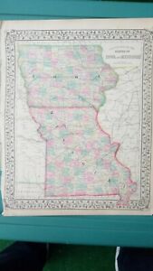
1870 Samuel Augustus Mitchell Antique State Map of Iowa and Missouri
ILS 329.64ILS 37.02 shipping1873 Mitchell's Atlas Map Iowa and Missouri, Authentic Hand-Colored 12 x 16"
ILS 370.55ILS 301.81 shippingAntique 1903 Map Shelby County Missouri Shelbyville Ivanhoe 28"X27"
ILS 33.31ILS 267.80 shipping1892 Color Single Page County Maps of Missouri and Iowa
ILS 51.36ILS 251.16 shippingARKANSAS TENNESSEE ALABAMA MISSISSIPPI U.S.A 1833 S.D.U.K.UNUSUAL ANTIQUE MAP
ANTIQUE MAP OF ARKANSAS TENNESSEE ALABAMA MISSISSIPPIILS 98.833 bidsILS 92.64 shippingEnding Today at 10:03PM PDT21h 58m1876 - Railroad Map of the United States-by Harrison & Warner -from County Atlas
ILS 99.86ILS 285.77 shipping1877 Twp. Plat Map STICKLERVILLE, SULLIVAN Co., MISSOURI ~ GREENCASTLE on Back
ILS 170.27Was: ILS 181.12ILS 75.78 shipping1864 Map Missouri and Iowa County Map Antique Original Hand Colored Mitchell
ILS 183.42ILS 258.20 shippingMissouri Campbell's Missouri 6 Counties Map - Hand Colored - 1873 Original
ILS 166.56ILS 256.98 shippingAntique 1877 Plat Map SCOTTSVILLE Twp., SULLIVAN Co., MISSOURI ~ PARSON Creek
ILS 170.27Was: ILS 181.12ILS 75.78 shipping1893 - Map - Carondelet; Irving Place; Benoist Heights, Mo -St. Louis County, Mo
ILS 110.98ILS 270.84 shipping1873 - Campbell's Map of Missouri - 4 Counties - Adrain - Monroe - Pike -Ralls
ILS 203.62ILS 288.81 shipping1876 - Map of Township 64 North; Range 10 West - Scotland County, Mo.
ILS 148.03ILS 287.18 shipping1867 County Map of States of Iowa and Missouri Mitchell Brothers Atlas St. Louis
ILS 185.24ILS 296.37 shipping1910 Color County Map State of Wisconsin and Missouri
ILS 40.24ILS 243.41 shippingAntique 1884 Map Of Mississippi
ILS 57.55ILS 247.45 shipping1873 Campbell Missouri County Map Callaway Cole Montgomery Osage Jefferson City
ILS 444.66Was: ILS 555.83ILS 74.07 shipping1886 Tunison Map Iowa Des Moines Cedar Rapids Council Bluffs Waterloo Fort Dodge
ILS 133.36Was: ILS 166.71ILS 74.07 shipping1876 Map - Township 65 North; Range 10 West -Business -Scotland County, Mo.
ILS 370.36ILS 293.74 shippingEngraving - Residence of James Whitsett, Esq. Franklin Co., Mo. - 1878 Atlas
ILS 148.03ILS 287.18 shipping1898 - Map - Franklin County, Mo. - Mozelle - Detmold - Townships 41 N. & 40 N.
ILS 148.03ILS 287.18 shipping1884 Rand McNally Map Missouri St. Louis Jefferson Kansas City - Yellow Version
ILS 44.47Was: ILS 55.58ILS 74.07 shipping1898 - Franklin County, Mo. - Portrait Department-Pictures of Prominent Citizens
ILS 185.09ILS 288.25 shipping1898 - Map of Franklin County, Missouri - Fract'l Townships 44-45, N. Range 11 W
ILS 129.51ILS 286.62 shipping1909 Antique Color Map Cedar County Missouri Filley Stockton Balm 29 X 25 #0388
ILS 147.85ILS 250.79 shipping1873 Campbell Missouri County Map Crawford Gasconade Franklin Washington Potosi
ILS 296.44Was: ILS 370.55ILS 74.07 shipping1878 Pitzman's Map-City of Fenton; Allenton (St. Louis), Missouri - Township 43
ILS 166.56ILS 287.73 shipping1919 Plat Map Benton & Polk Townships Adair County Missouri
ILS 64.85ILS 254.72 shipping1899 Color Map States of Missouri & Iowa Very Clean Detailed Near Mint Map
ILS 51.36ILS 251.16 shipping1888 Color County Map States of Iowa and Missouri see title page picture
ILS 51.36ILS 251.16 shipping1874 Colton Map Missouri St. Louis Kansas City Jefferson Columbia Springfield MO
ILS 222.33Was: ILS 277.91ILS 74.07 shipping1873 Campbell Missouri Geological Map Ironton Potosi Ozark Iron Mountain Delta
ILS 370.55Was: ILS 463.19ILS 74.07 shipping1876 Map - Township 65 North; Range 11 West - Residence -Scotland County, Mo.
ILS 277.73ILS 290.99 shipping1873-Campbell's Map of Missouri - 5 Counties-Greene-Stone-Christian - Two More
ILS 203.62ILS 288.81 shipping1915 Plat Map ~ MARION Twp. GRUNDY Co. ~ MISSOURI Genealogy Ancestry History
ILS 170.27Was: ILS 181.12ILS 75.78 shippingBrown County, Horton, Kansas, Vintage Map - Schools, Churches, County Roads
ILS 37.06ILS 247.05 shippingOld Antique 1899 Plat Map ~ Mc CUNES Sta. Twp., PIKE Co., MISSOURI ~ READING P.O
ILS 170.27Was: ILS 181.12ILS 75.78 shippingLeslie Township 1914 Plat Map Carroll County Missouri 14½" x 17½"
ILS 107.27ILS 253.31 shipping1873 Missouri County Railroad Map St. Louis Jefferson City Columbia Sedalia MO
ILS 518.77Was: ILS 648.46ILS 74.07 shipping1872 Campbell Engelmann's Climatological Map of Missouri Climate Zones Rainfall
ILS 222.33Was: ILS 277.91ILS 74.07 shippingOld Antique 1899 Plat Map ~ .BOOTH Twp., PIKE Co., MISSOURI ~ BOWLING GREEN
ILS 170.27Was: ILS 181.12ILS 75.78 shipping1898 - Map-Franklin County, Missouri- St. Clair -Township 41 N. Range 111 & IV W
ILS 148.03ILS 287.18 shippingTown of Carrollton South Part 1914 Plat Map Carroll County Missouri 17½" x 29"
ILS 107.27ILS 253.31 shippingOld Antique 1899 Plat / County Map ~ PIKE COUNTY, MISSOURI ~ BOWLING GREEN
ILS 170.27Was: ILS 181.12ILS 75.78 shipping1898 - Map - Franklin County, Mo.-Cities of Sullivan, Missouri - Southpoint, Mo.
ILS 185.09ILS 288.25 shipping1893 -Map-City of Old Orchard & Lockwood Subd., Mo - St. Louis County, Mo.
ILS 148.03ILS 271.91 shipping1893 - Map -Cities of Pine Lawn; Kesting Heights; Mo. -MORE - St. Louis Co., Mo.
ILS 92.45ILS 270.28 shipping1919 Plat Map Pettis or Walnut Townships Adair County Missouri Millard Yarrow
ILS 64.85ILS 254.72 shipping1873-Campbell's Map of Missouri - 5 Counties - Camden-Dallas-Hickory -Two More
ILS 203.62ILS 288.81 shipping1898 - Map - Franklin County, Mo. - Catawissa - Dundee - Townships 43 N. & 44 N.
ILS 148.03ILS 287.18 shipping1898 - Map - Franklin County, Missouri - Gray Summit - Township 42 N. Range 111
ILS 148.03ILS 287.18 shippingMissouri - Map of Ellisville, Missouri - St. Louis County, Mo. - 1909
ILS 185.09ILS 273.02 shippingOld Antique 1877 Plat Map ~ MEDICINE P.O., SULLIVAN Co., MISSOURI ~ MUDDY CREEK
ILS 170.27Was: ILS 181.12ILS 75.78 shippingSoil Survey Map Polk County Missouri Bolivar Humnasville Fair Play Aldrich 1926
ILS 166.75ILS 250.86 shippingOld Antique 1877 Plat Map ~ BOMANEVILLE - LINDLEY Twp., SULLIVAN Co., MISSOURI
ILS 170.27Was: ILS 181.12ILS 75.78 shippingOld 1890 R McNally Atlas Railroad & County Map MISSOURI ~ Free S&H
ILS 76.63Was: ILS 81.52ILS 75.78 shippingColor Soil Survey Map Cooper County Missouri Boonville Bunceton Blackwater 1909
ILS 166.75ILS 250.86 shipping1873-Campbell's Map of Missouri -7 Counties - Davies - Dekalb - Gentry - 4 More
ILS 203.62ILS 288.81 shipping1873 Campbell City Map St. Louis Missouri Lafayette Park Fairgrounds Courthouse
ILS 296.44Was: ILS 370.55ILS 74.07 shipping1873 Campbell Missouri County Map Douglas Ozark Texas Wright Houston Hartville
ILS 296.44Was: ILS 370.55ILS 74.07 shipping